Must-Visit Attractions
A Wander around the Hualien Countryside

Situated at the foot of Liyu Mountain, Liyu Lake is located in Chinan Village, Shoufeng Township, and got its name exactly from Liyu Mountain to its east. In recent years, Liyu Lake has gained increasing attention because of the annually Red-faced Rubber Duck event and fabulous night fountain shows, making it a must-visit spot in Hualien.
With the well-designed cycling path and campsites around it, Liyu Lake is a perfect destination for recreational and family activities. Also, you can try out the local specialty, the Live Jumping Prawns, and enjoy a slower pace of life.
-
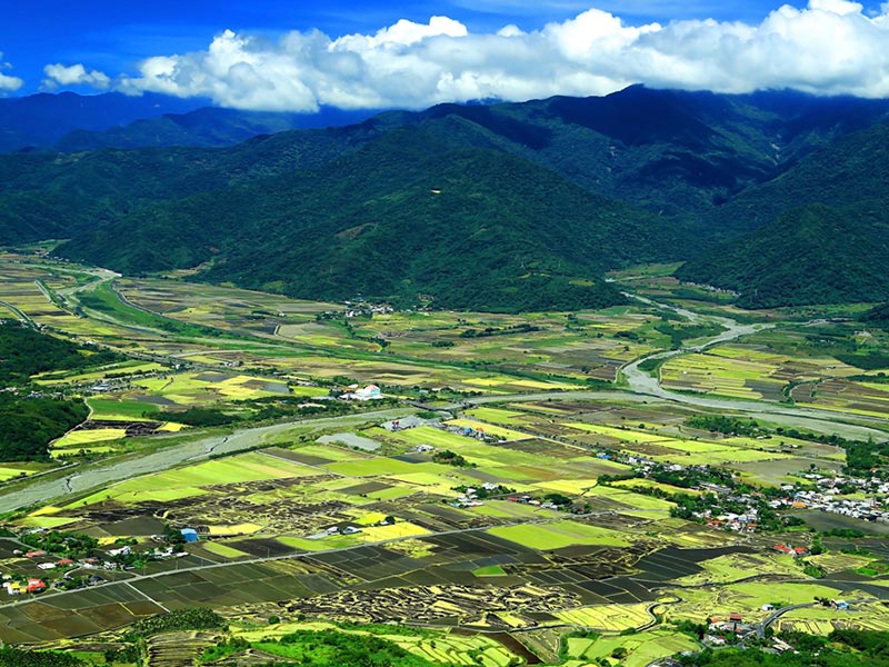
Every August to September is the flowering season of daylilies on Liushishi Mountain. Visitors can stand at any of the pavilions to admire the vast field of golden daylily flowers, or look down on the scenic East Longitudinal Valley.
During the flowering season, Liushishi Mountain is the most crowded and traffic controls will be in place. For those who want to explore the tranquil charm of the mountain, we strongly recommend visiting in winter. The field of bright yellow rapeseed flowers blanketed the Longitudinal Valley will leave you with unforgettable memories.
-
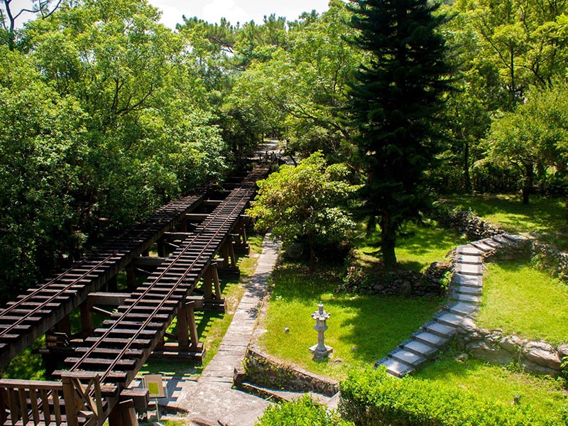
Once nicknamed as "Little Shanghai," Lintianshan Forestry Culture Park (known as "Morisaka" in Japanese) was the fourth largest forestry center in Taiwan, next to Basianshan, Alishan and Taipingshan.
As time goes on, its glorious past has gradually faded. However, relics such as lumbering tools, old firefighting apparatus/equipment and other historical documents are well-preserved and displayed in Lintian Mountain Forestry Culture and History Center, showcasing the once-thriving history of forestry.
-
The best time for butterfly watching in the Butterfly Valley is from March to August. Here, more than thirty species of butterflies can be found: the common bluebottle, the great orange tip, the common fivering and so on. Moreover, tourists can enjoy the glow of black-winged fireflies from March to May, or appreciate the twinkling light of the firefly Pyrocoelia praetexta Olivier from September to November. When dusk falls, fireflies sparkle and flicker in the forest to create an amazing sight.
Butterfly Valley is not only an outdoor eco-classroom for families but also a perfect getaway to enjoy open-air hot spring and forest bathing!
-
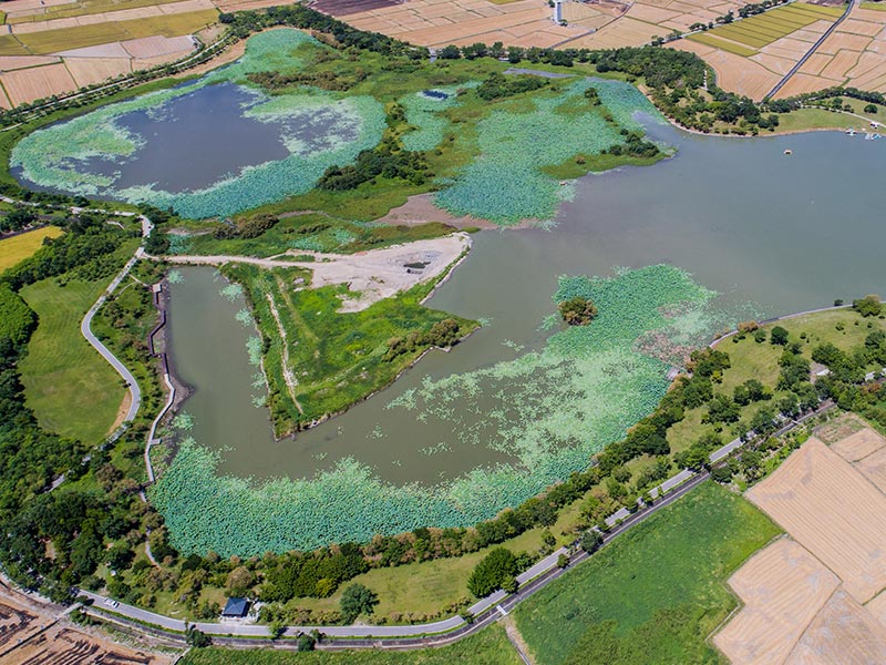
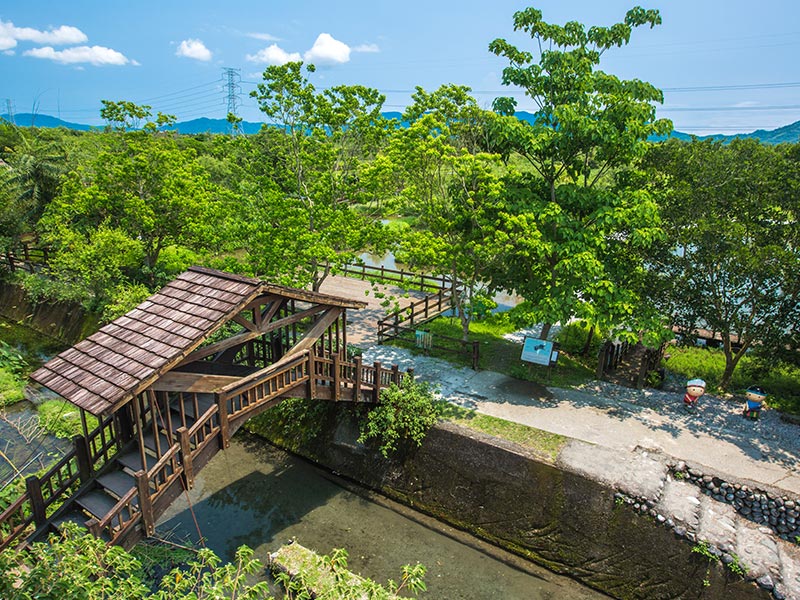
Located in Guangfu Township, Hualien County, Mataian Wetland is a marsh characterized by never-ending bubbling fountains, thus providing ideal habitats for native fauna and flora: water birds, frogs, freshwater benthic fishes and so on.
To adapt to the wetland environment, local Amis residents developed "Palakaw," a unique and sustainable way of fishing still in practice nowadays. Besides experiencing an eco-friendly method of fishing, visitors to the Mataian Wetland can savor salt-crusted baked fish, dishes made from freshly-caught fish and shrimp, and the special Amis stone hot-pot, satisfying the appetite with indigenous tasty cuisine.
-

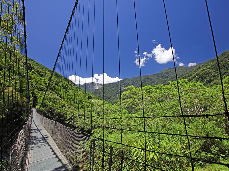
Walami Trail
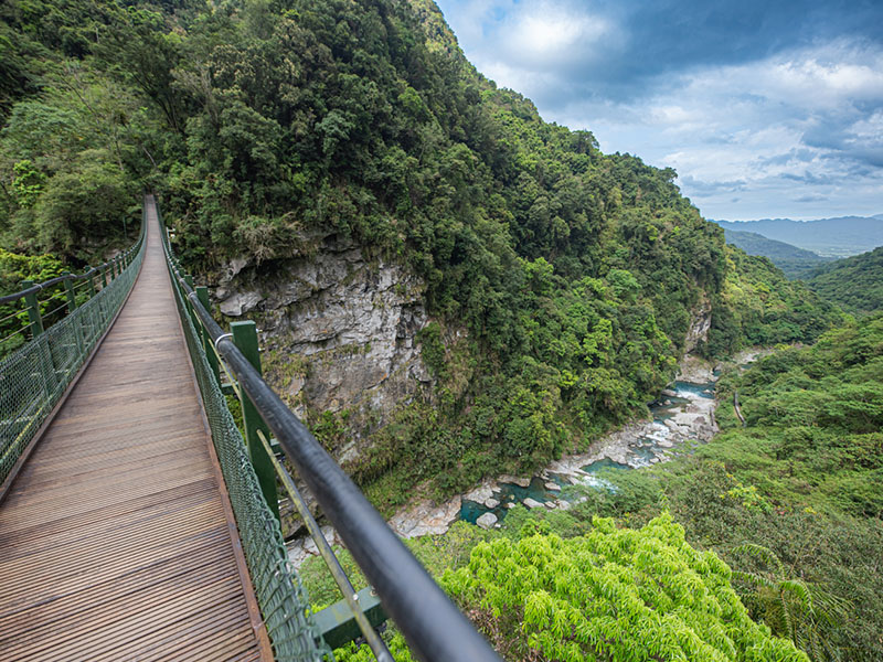
About 13.6 kilometers long, the Walami Trail is part of the eastern section of Batongguan Historical Trail built during Japanese rule of Taiwan. Once getting to the trail entrance, hikers can enjoy spectacular views of Nanan Waterfalls. In addition to lush green ferns, low-altitude natural hardwood forest and Japanese cedar trees thrive all the way. With an abundance of wildlife including birds and insects, the Walami Trail offers stunning mountain views and is a great trail for all ages.


Slow Living in Taitung
-
Due to its advantageous location, the Luye Highland offers excellent views of the highland area and beautiful scenery along Beinan River, making it the greatest place to do air activities in eastern Taiwan. The best time to visit the Luye Highland is from June to August when the annual hot air balloon festival takes place. It is highly recommended that you have a hot air balloon ride to fly up high, enjoy the breathtaking vista of the East Longitudinal Valley, and feel the excitement as your journey begins.
-
Situated in the northern suburbs of Taitung City, the Liji Badlands by Beinan River is also known as the Liji Moon World. The area comprises the "Liji Melange," which is regarded as a geological national treasure in Taitung.
The Liji Melange is composed of mudstones formed from deposits of very fine-grained clay particles. Because mudstones have low porosity and low permeability, the striking badlands scenery takes shape. You can walk along the walkway to take a close look at the Liji Badlands as if you are visiting an exhibit pavilion featuring the history of geology which would be very impressive.
-
Mr. Brown Avenue
Surrounded by rice paddies swaying on both sides, Mr. Brown Avenue is a small country road in Chishang Township. A series of commercials for Mr. Brown Coffee made the road incredibly famous and therefore received another nickname, the "Green Road of Paradise."
The vast rice paddy field changing from green into golden color against the backdrop of undulating mountains constitutes beautiful scenery that looks like a postcard. Just indulge in the picturesque scenery while cycling or strolling through the endless rice fields and get yourself away from urban chaos.
-
Dapo Pond, originally called Dabi, is an inland freshwater marsh. It was once entitled "the Fishing Ground of Chishang" and listed as one of the 10 top sights in Taitung.
Thanks to its well-preserved environment, Dapo Pond not only has abundant natural resources, but also offers magnificent views, making it a great holiday destination where tourists can walk along the shores of the pond on the walkway, or enjoy a relaxing ride along the bike route. Want to space out for a while? Dapo Pond is your MUST-VISIT!
-
Located at the Heping Community of Luye Township, Zhongxin Sentinel is at a high point where the Luye River and Beinan River converge. The view is expansive and one can even overlook the surroundings, including Mt. Dulan and Mt. Baizinan.
Zhongxin Sentinel has a total of 3 barracks and 1 outpost. In 2022, renovation was done by combining the existing buildings with modern space and traditional elements. The original appearance was retained and new space was added. Along with the semi-covered rain shelter, the place has a hipster and modern atmosphere, providing visitors with a spot to rest and escape the hot sun.
-
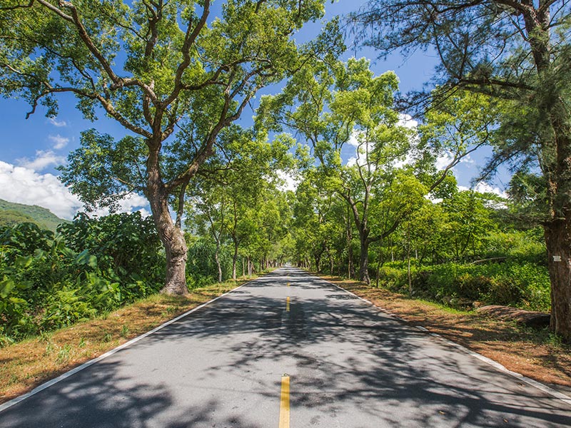
Wuling Green Tunnel
As a part of the Wuling Section of Provincial Highway No. 9, the 4.5-kilometer-long Wuling Green Tunnel is shaded with camphor trees and horsetail trees standing on both sides of the road. In this charming green tunnel, the 2626 Saturday market held every 2nd and 4th Saturday in a month is a great event not to be missed.
Surrounded by the shades of green, you can feel the gentle breeze blowing against your faces when sunlight filters through the leaves. Because the traffic volume is low, it is highly recommended that you lie on the shaded road or enjoying cycling to embrace this slower pace of life.